


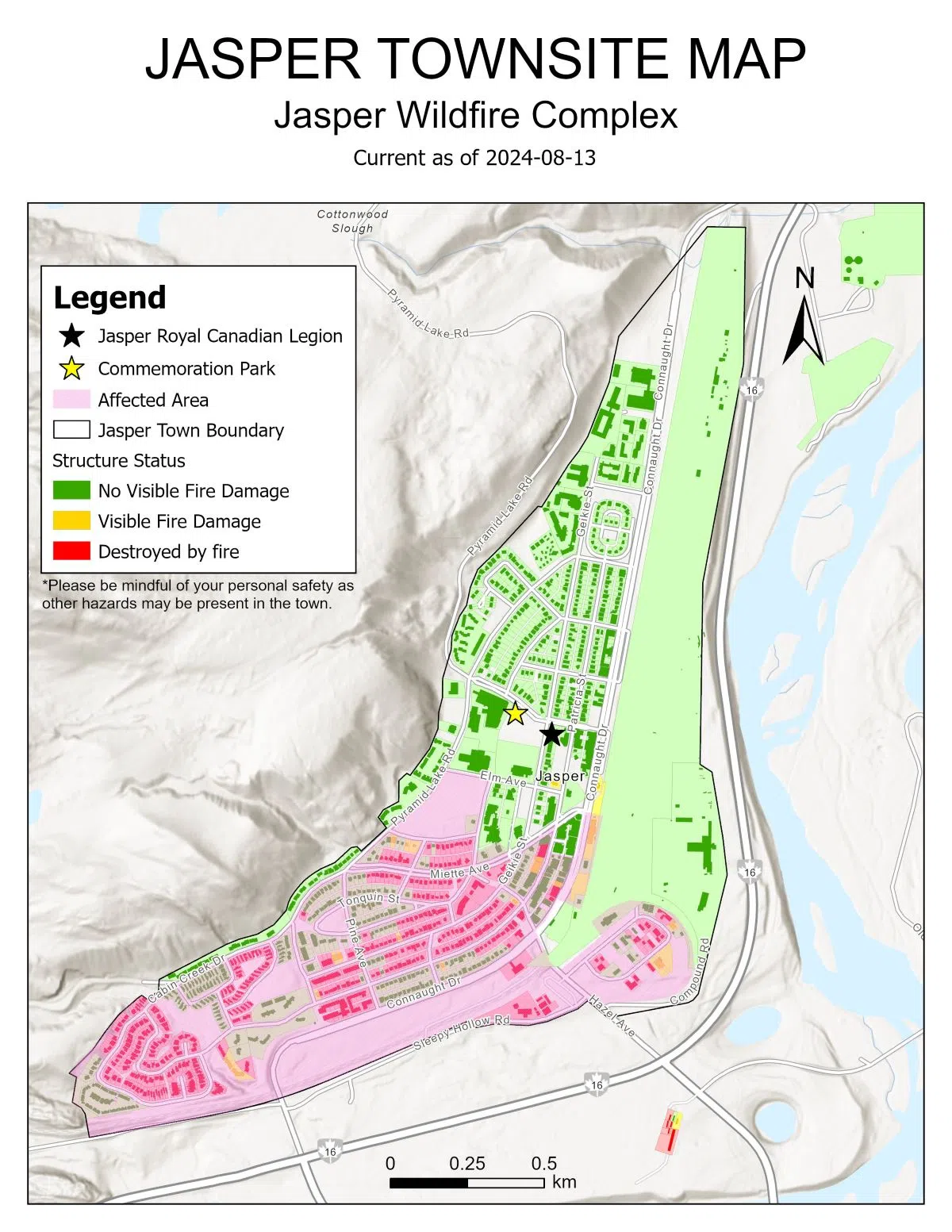
Officials with Jasper National Park have provided updates on the Jasper Complex Wildfire, the progress of re-entry efforts for Jasper residents, and have also released a map of the townsite detailing the extent of the damage caused by the fire.
The map shows the most extensive damage was concentrated in the southern and western residential areas resulting in the complete destruction of many homes. However, most of the townsite north of Elm Avenue appears to be relatively unaffected.
Staff with the Incident Command Centre say they continue to make good progress towards meeting all the re-entry criteria before the proposed Aug. 16 re-entry date. Officials are stressing that this re-entry date is for residents only and are working on plans to streamline the process.
Crews say they are continuing to work around the clock in order to restore critical services. Water chlorination is completed and a boil water advisory is in place for the western part of the town that was most affected by the fire.
Representatives with insurance companies in the area say they will continue to complete damage assessments around town for the rest of the week. Businesses with questions or concerns are being asked to contact Community Futures West Yellowhead.
Officials say the northern perimeter of the Jasper Complex Wildfire remains 99 per cent contained, however, the rest of the fire is still classified as out of control and is now estimated to be 33,400 hectares. Crews say the fires in the Utopia and Miette areas have now been extinguished.
Residents are also once again being reminded that piloting drones in Jasper National Park is illegal and anyone caught could face a fine of up to $25,000.00.
The Jasper Airstrip also remains closed for the time being in accordance with NOTAM –Canadian Aircraft Regulation 601.15(a).
Updates on re-entry progress will continue to be posted to the Municipality of Jasper website as they become available.


Comments